

Mapping Each Shape And Contour
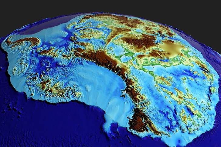
With the gaps in the old radar data filled in, we now have a high-precision map of Antarctica’s ice sheet, complete with the exact shapes and contours found in the region’s unexplored areas. Looking at it, it can’t be denied that the Antarctic isn’t simply a big block of ice.
Although much more advanced than past maps of the continent, the images generated by BedMachine Antarctica used a similar kind of color scheme to signify an area’s elevation. If you look at the project’s visual aids, you’ll notice that areas above sea level are rendered in brown, green, and yellow.